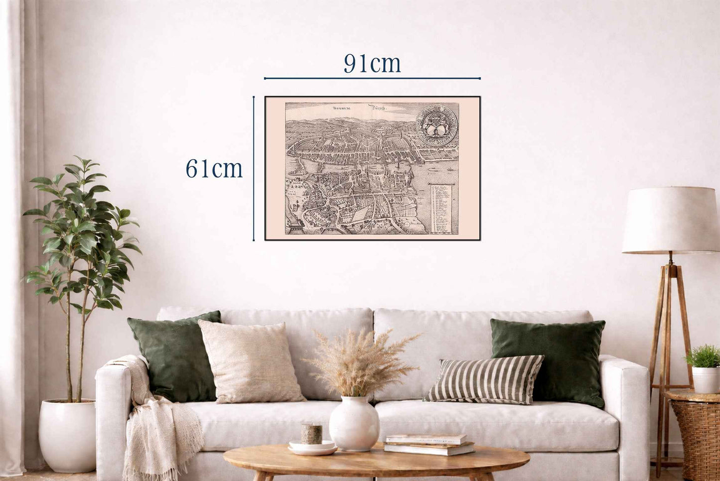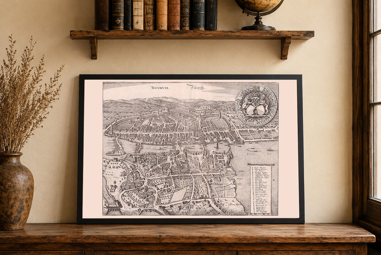


This detailed engraved view titled “Tigurum. Zurych.” was produced in 1654 by the Merian workshop for the third edition of the “Topographia Helvetiae,” an influential illustrated geography published in Frankfurt by Matthaei Merian seel. Erben. The work is attributed to the engraver Matthaeus Merian, geographer Martin Zeiller, and Caspar Merian, and belongs to a monumental 16-volume series documenting German-speaking regions, including Switzerland. The image presents an expansive bird’s-eye view of Zurich (Zurych), Switzerland, with the city’s prominent urban layout, rivers, bridges, and surrounding cultivated fields rendered in precise detail. The landscape fills most of the page, and the Limmat River can be seen bisecting the medieval core, with Zurich See (Lake Zurich) spreading out to the right. There is an inset with the city’s coat of arms at upper right and a numbered legend at lower right identifying principal sites and features. The structures are tightly clustered, with churches and towers standing out, while hilly terrain and rural plots anchor the background and foreground.
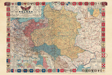
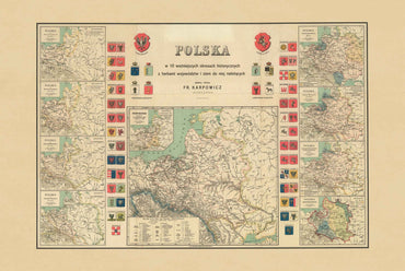
This is a reproduction print of a historical map