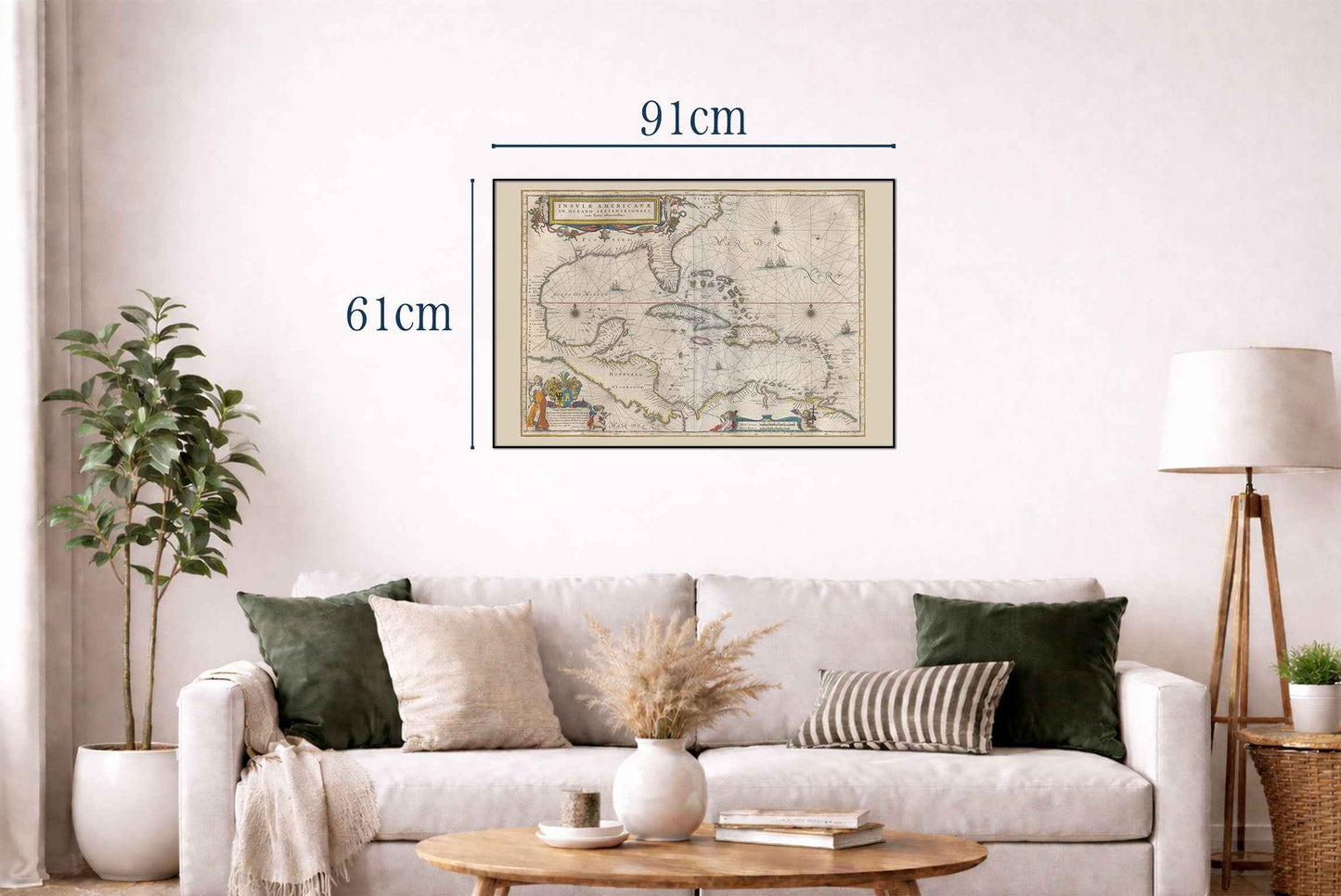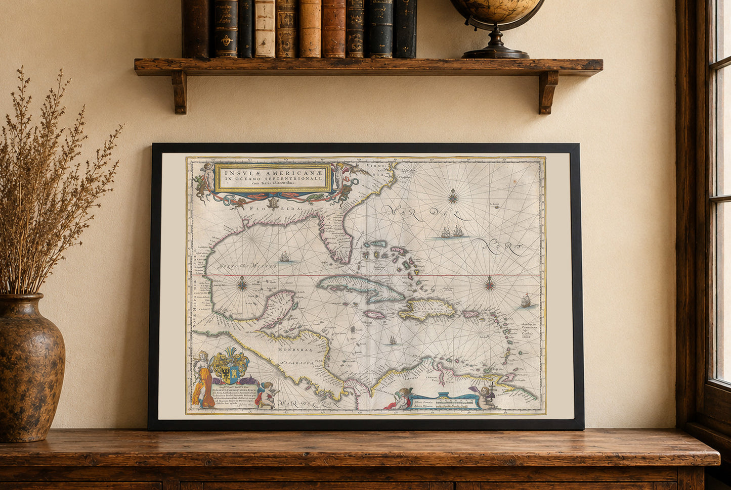


The map titled "Insvlae Americanae In Oceano Septentrionali" was created by Joan Blaeu in 1662. It is part of Blaeu's illustrious Atlas Maior, specifically in volume 11, which focuses on America. This work is a regional atlas map of the West Indies, notable for its artistic and geographical detail, and it was published by Joan Blaeu, a significant figure in cartography during the 17th century. The map is a beautifully engraved piece, characteristic of the high-quality production typical of Blaeu's atlas. The cartographic style includes detailed illustrations and vibrant hand-colored elements. The use of compass roses and rhumb lines indicates the navigational focus of the map, aiding sailors in plotting courses across the Caribbean Sea
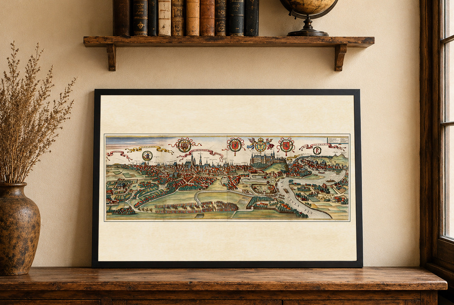
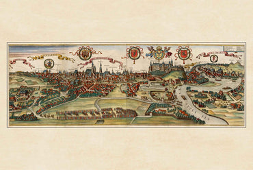
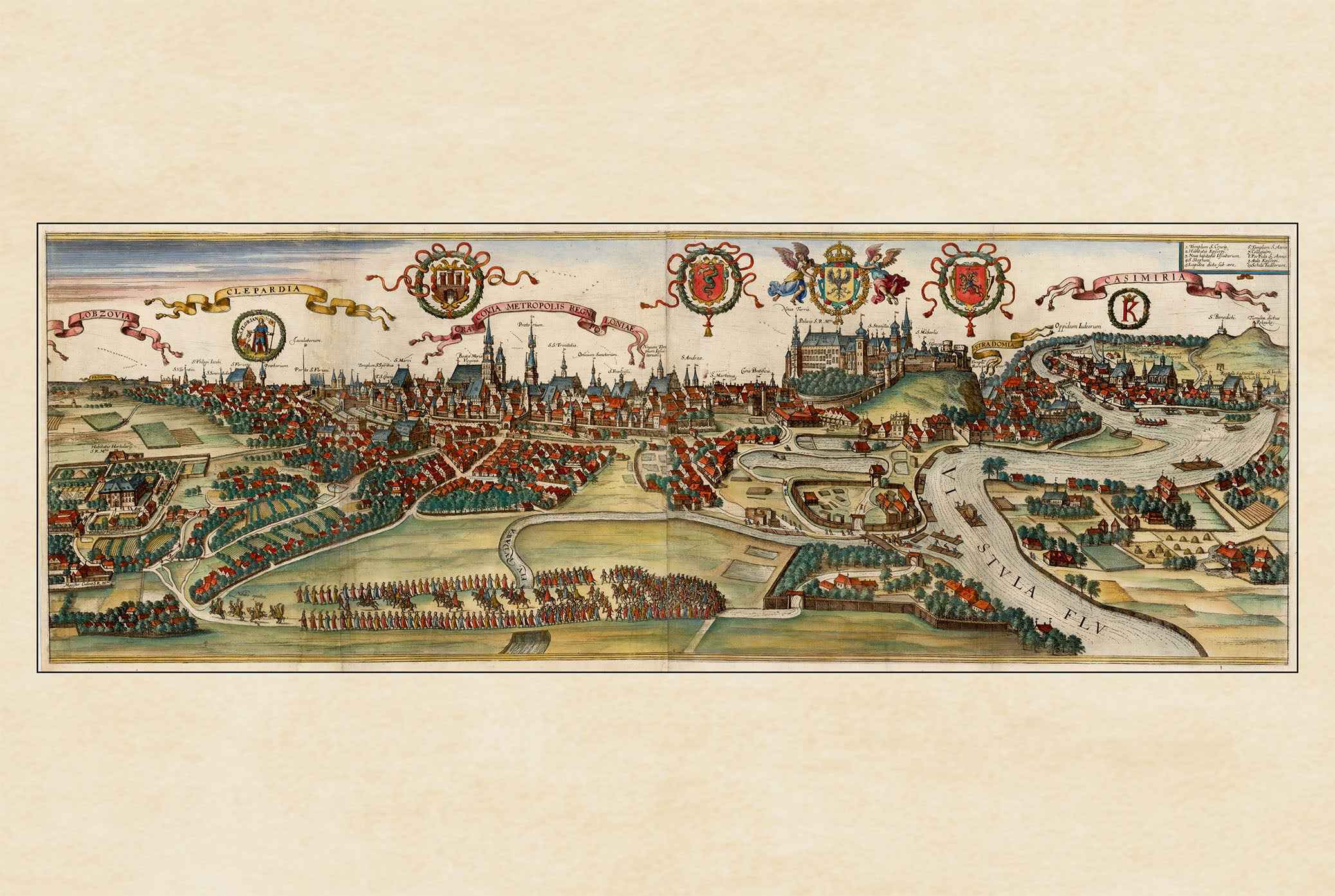
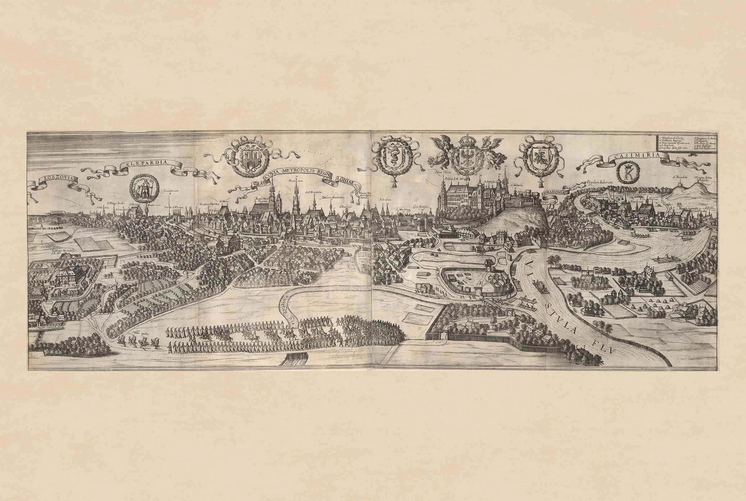
This is a reproduction print of a historical map