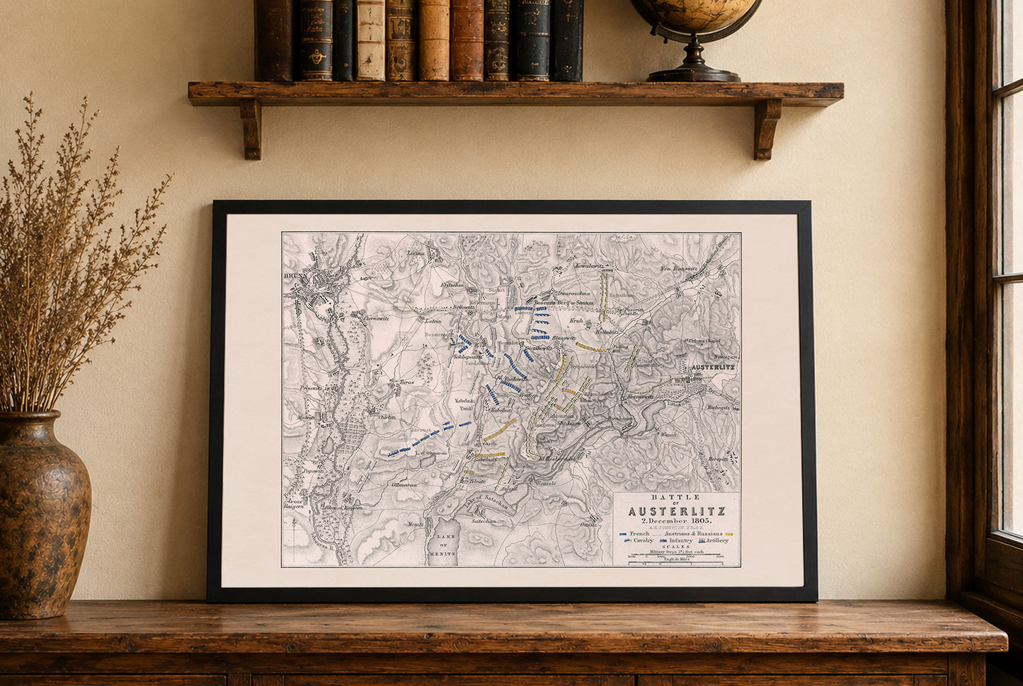


Explore one of the most decisive battles in European history with this exceptional Battle of Austerlitz Map Poster, created by Alexander Keith Johnston and published by Sir Archibald Alison as part of an atlas accompanying History of Europe. This detailed military map illustrates the positions and movements of French, Austrian, and Russian forces during the famous Battle of Austerlitz on December 2, 1805.
Carefully engraved and hand-colored, the map employs classic 19th-century military cartographic techniques to depict troop deployments, battlefield geography, and strategic movements. French forces are distinguished in blue, while Austrian and Russian formations appear in yellow, allowing viewers to clearly follow the complex maneuvers that shaped the outcome of the battle. Relief and terrain are represented through hachures, providing valuable topographical context for understanding the engagement.
The map focuses on the area surrounding Austerlitz and Brünn (modern-day Brno), highlighting key positions, roads, villages, and battlefield features that played critical roles in Napoleon’s strategy. Its precise design reflects the military cartography standards of the 19th century, balancing historical accuracy with visual clarity.
Widely regarded as Napoleon Bonaparte’s greatest battlefield triumph, the Battle of Austerlitz marked a turning point in the Napoleonic Wars. The French victory over the combined Austro-Russian armies dramatically reshaped the political landscape of Europe and solidified Napoleon’s reputation as one of history’s greatest military strategists.
Perfect for military historians, collectors, educators, students, and enthusiasts of Napoleonic history, this historical battle map poster brings strategic insight and historical significance to offices, libraries, studies, classrooms, and military-themed interiors.
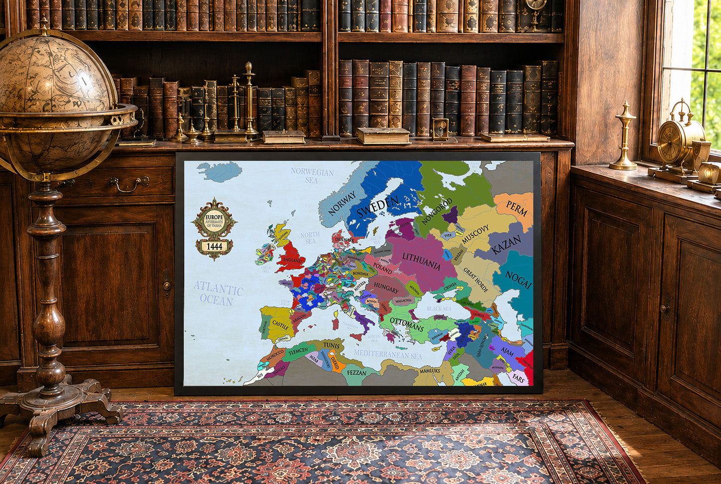
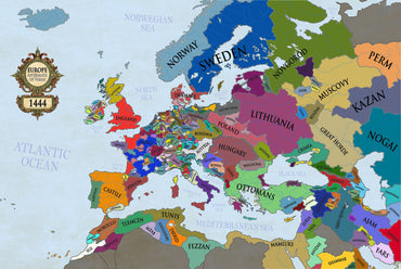
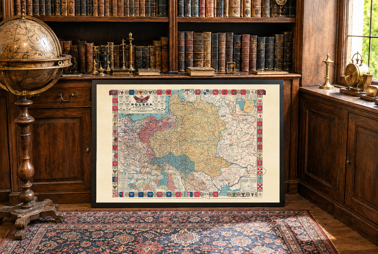
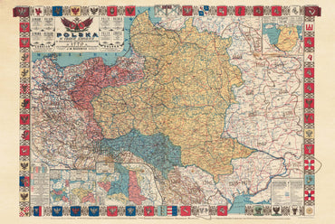
This is a reproduction print of a historical map