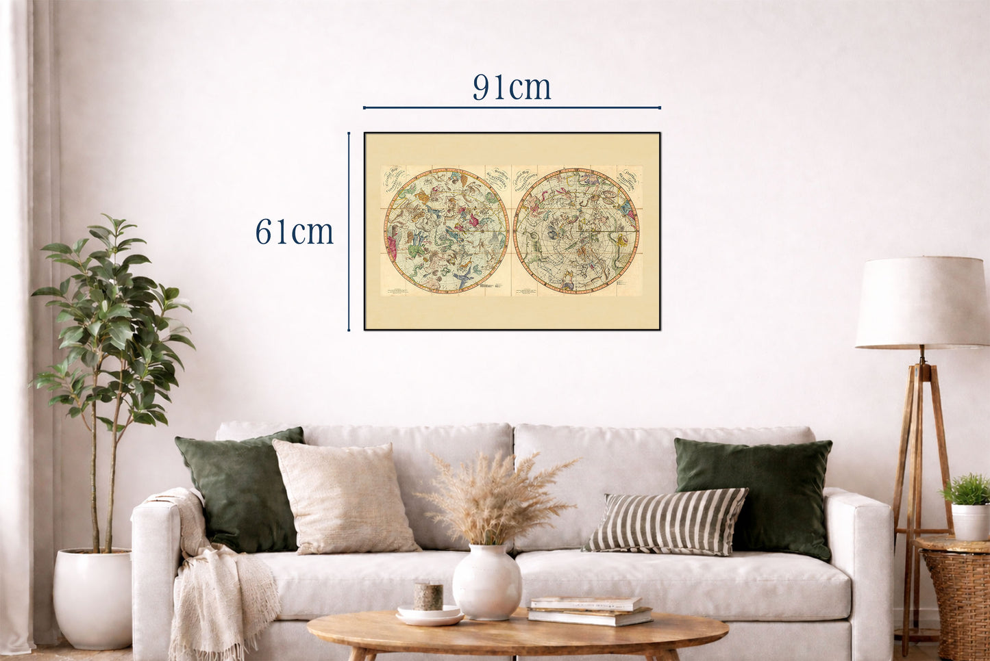


Explore the wonders of the night sky with this extraordinary Celestial Constellation Map Poster, featuring the celebrated 1820 star charts created by Richard Brookes and published by William Darton in London. This beautifully illustrated celestial map presents the constellations of both the Northern and Southern Hemispheres, combining scientific precision with the artistic elegance of early nineteenth-century astronomy.
Originally produced as a hand-colored folding atlas mounted on linen, the maps display the night sky in two circular hemispheres, with every constellation illustrated as mythological figures, animals, or symbolic objects. The detailed artwork reflects centuries of astronomical tradition while preserving the beauty of classical celestial cartography.
The star charts include constellation boundaries, traditional star names, and Flamsteed designation numbers, the cataloging system introduced by the renowned astronomer John Flamsteed. Stars are carefully illustrated in varying sizes according to their apparent brightness, making the maps both scientifically informative and visually captivating.
Created during a period of remarkable advances in astronomy and global exploration, these celestial maps served as valuable references for astronomers, navigators, and scholars. Their elegant composition and timeless design make this vintage star map poster a perfect addition to offices, libraries, observatories, classrooms, or any home inspired by science, history, and space exploration.
Ideal for astronomers, educators, collectors, mythology enthusiasts, and lovers of antique maps, this reproduction beautifully captures the artistry and scientific achievement of nineteenth-century celestial cartography.
This is a reproduction print of a historical map