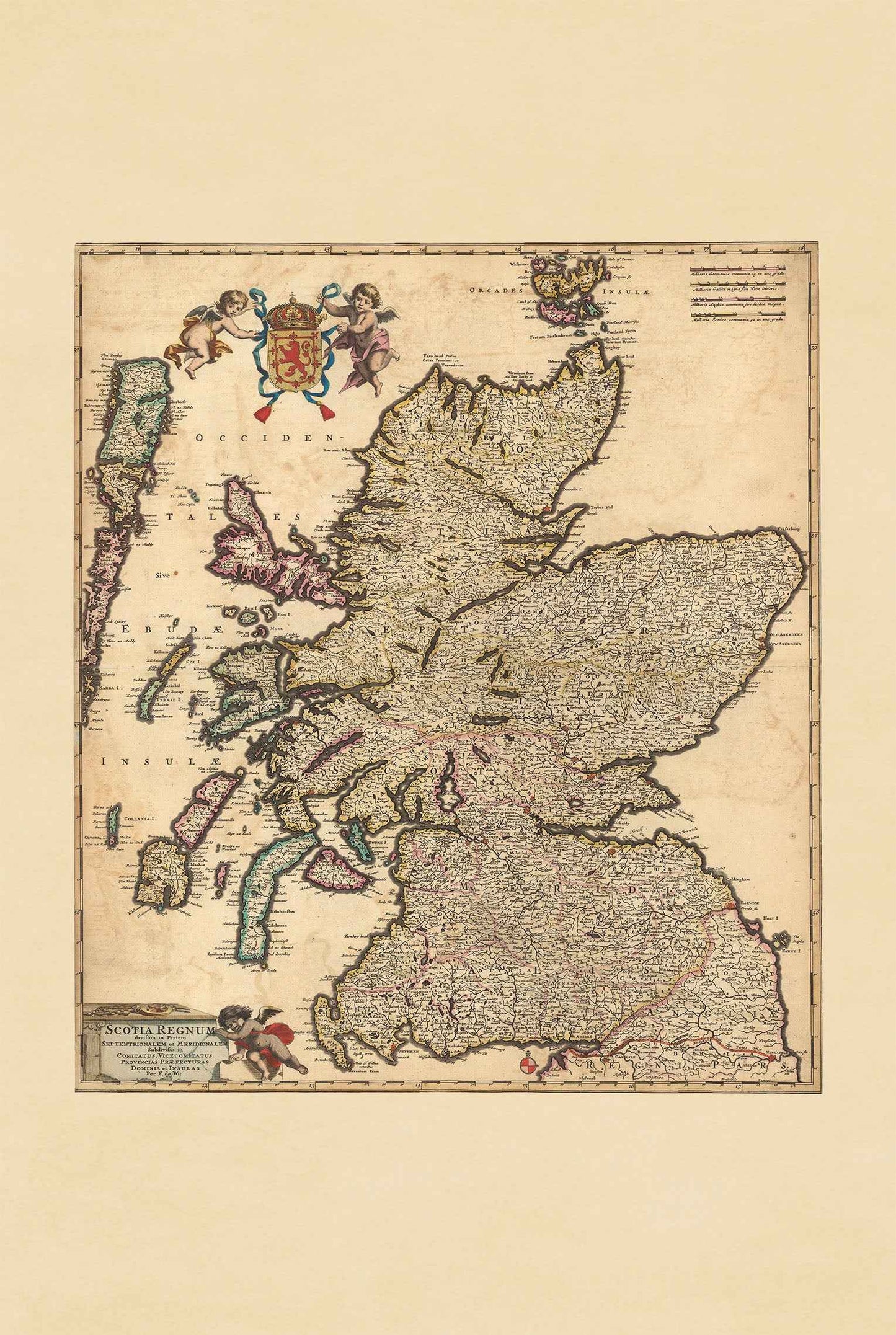


Discover the elegance of 17th-century cartography with this stunning Scotland Map Poster titled “Scotia Regnum,” created by Frederick de Wit around 1690. Published as part of the renowned “Atlas Minor sive Geographia Compendiosa” compiled by Nicolaes Visscher, this richly detailed historical map presents Scotland in a beautifully decorative Baroque cartographic style.
Expertly engraved and hand-colored, the map depicts Scotland divided into its northern and southern regions, further subdivided into counties, provinces, and islands. Elegant color outlines emphasize administrative boundaries while enhancing the map’s visual depth and antique aesthetic. Mountains and rugged terrain are illustrated using traditional hachure techniques, adding dramatic texture characteristic of late 17th-century European mapmaking.
The composition features ornate decorative elements typical of the golden age of Dutch cartography. In the upper corner, a regal coat of arms supported by cherubs adds grandeur and symbolism, while the title is displayed within an elaborate cartouche accompanied by additional decorative figures. These artistic embellishments reflect the Baroque fascination with heraldry, ornamentation, and geographic exploration.
The map provides a comprehensive view of historical Scotland, including cities, towns, waterways, lakes, ports, mountains, and the Orkney Islands. The detailed representation of Scotland’s regions and islands highlights the geographic complexity and political divisions of the kingdom during the period.
Perfect for collectors, historians, travelers, genealogy enthusiasts, and admirers of Scottish heritage, this vintage Scotland poster makes an elegant wall decor piece for offices, libraries, studies, and classic interiors inspired by history and traditional European design.
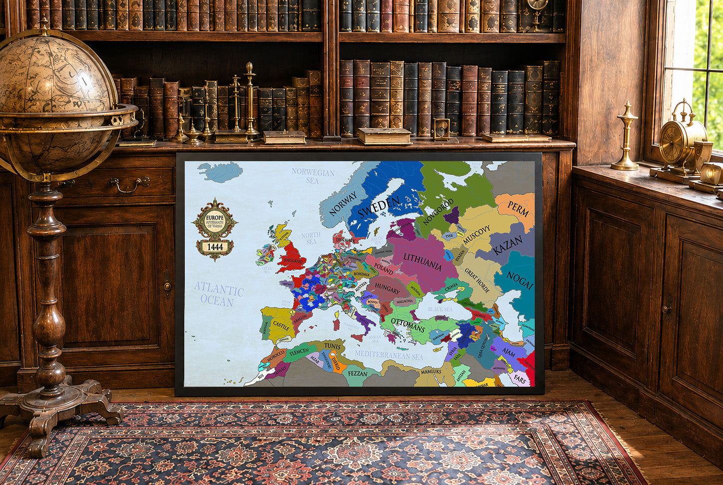
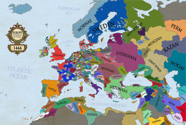
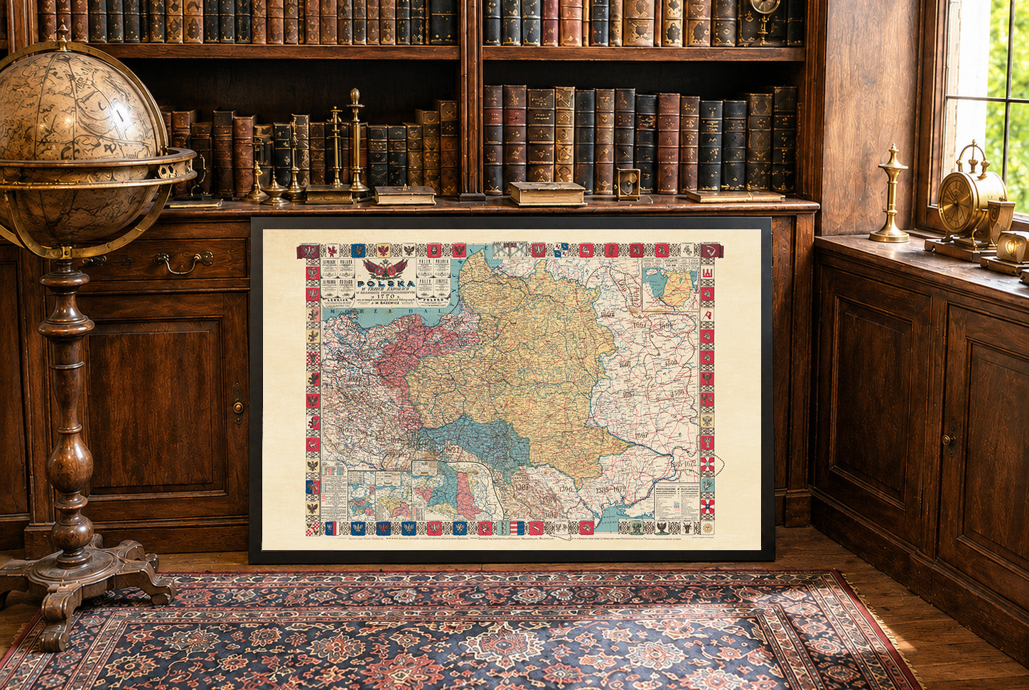
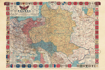
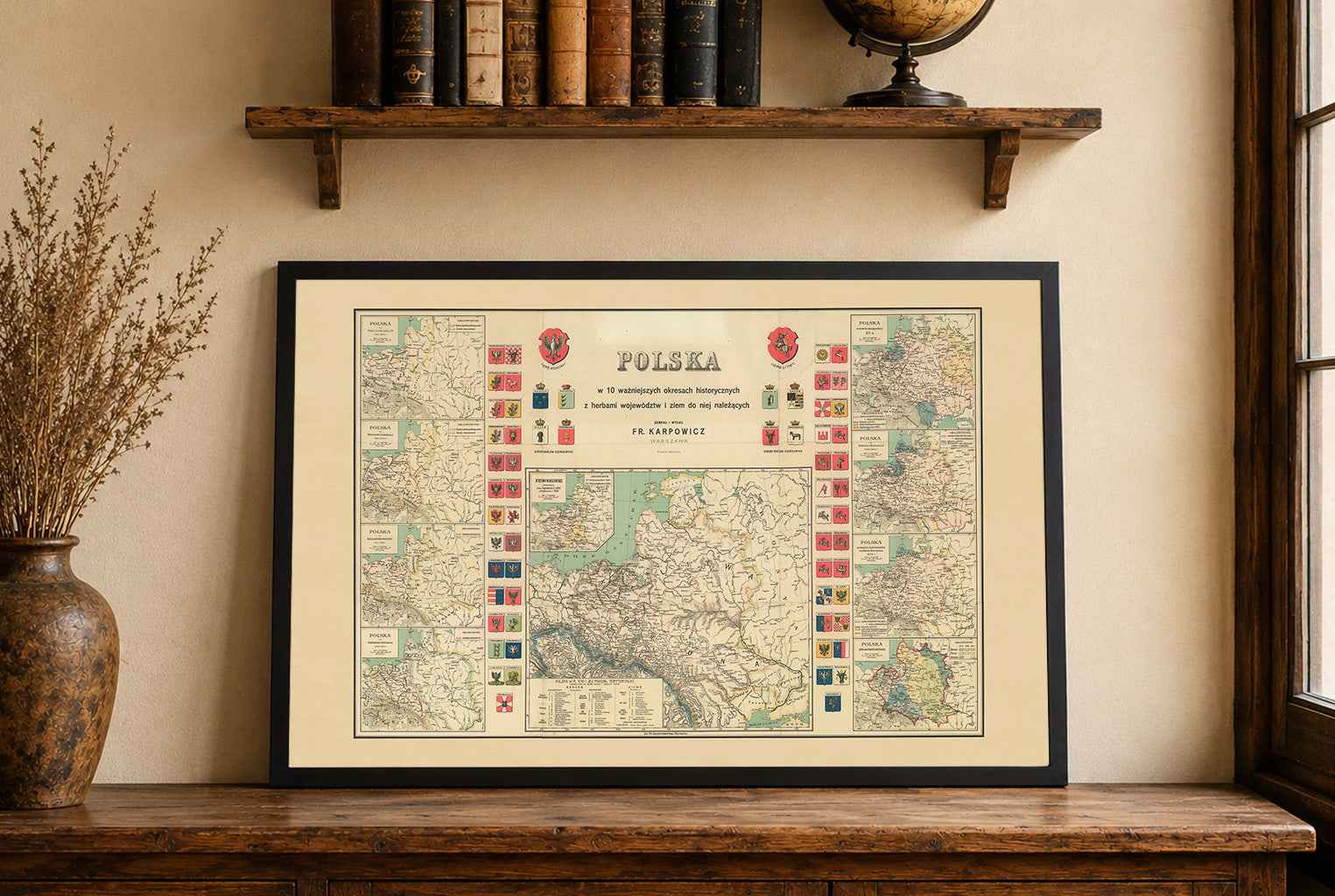
This is a reproduction print of a historical map